
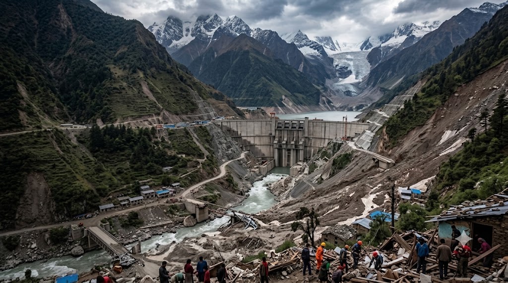
The wall of mud, ice, rock and water that swept through the Nepal-Tibet border region on August 26 has become one of the Himalayan region’s deadliest disasters in recent years. Hundreds of deaths have been reported, while authorities are searching for thousands of missing people, including hundreds of foreign tourists and pilgrims. Villages, bridges, roads, electricity infrastructure and hydropower facilities have left an unprecedented trail of yet another disaster in the Himalayan areas.
The disaster has once again brought growing concerns over development versus ecological balance into sharp focus. Preliminary evidence points towards a massive ice-rock or glacier collapse that sent debris into the Lhende Khola river system. International Centre for Integrated Mountain Development (ICIMOD) has cautioned that investigations are continuing and that the precise role of climate change in this particular event remains under study. What the disaster does expose is something broader: the growing collision between unstable Himalayan geology, rapidly changing glaciers and rivers that cross international borders.
How Disaster Struck Nepal Without Warning
The recent Rasuwa flood surged through Nepal with extraordinary force, producing a rapid flood wave across the Trishuli basin. ICIMOD reported that water levels at Galchhi rose by up to nine metres in 30 minutes, while Malekhu recorded a roughly seven-metre rise over the same period. Scientists are investigating whether an ice-rock avalanche from high altitude triggered the event; a remaining river blockage may still pose a risk of another sudden downstream surge. Initial reports described a magnitude-5-class seismic event, but subsequent assessments increasingly indicate that the trigger came from a glacier or ice-rock collapse and debris flow rather than a conventional earthquake.
A similar cross-border disaster struck in July 2025, when a glacial lake on Tibet’s Purepu Glacier drained suddenly into Nepal. Nepal’s hydrology authorities attributed the flood to the glacial-lake outburst, which destroyed the Rasuwagadhi “Friendship Bridge,” disrupted the Nepal–China trade corridor, damaged infrastructure along the river, and caused severe loss of life.
Together, the events show how glacier and landslide-related hazards beginning upstream can rapidly cross borders. They reinforce the need for real-time monitoring, transparent data exchange, and warning systems that give downstream Nepali communities enough time to evacuate.
China’s Mega-Dam Enters the Debate
China has spent decades building dams, roads, railways and other large infrastructure projects across the Tibetan Plateau. Its latest undertaking is the enormous hydropower development on the Yarlung Zangbo — the river that becomes the Brahmaputra after entering India and later flows into Bangladesh.
That vulnerability is attracting particular attention because China has begun constructing what is expected to become the largest hydropower project in the world. The project on the lower Yarlung Zangbo is expected to consist of five cascade hydropower stations and could generate roughly 300 billion kilowatt-hours annually. Reuters reported an estimated price tag of at least $170 billion. The river plunges around 2,000 metres over only 50 kilometres in the region, creating enormous hydropower potential and formidable engineering challenges.
India and Bangladesh have raised concerns because millions of people live downstream. Critics also point to the project’s location in a geologically active Himalayan region. Strategic affairs commentator Brahma Chellaney described the proposed development as a potential “water bomb” if a catastrophic structural or seismic event were ever to occur. That description represents his assessment, not evidence that the current Nepal disaster was connected to the project.
Earlier, China’s Three Gorges Dam showed the world the wider costs that can accompany mega-hydropower projects: while it generates vast amounts of electricity and supports flood control, it displaced about 1.3 million people and has been linked to landslide risks, sediment disruption and downstream ecological changes. Similar concerns have emerged around Chinese-backed projects under the China-Pakistan Economic Corridor (CPEC). The 720-MW Karot Hydropower Project affected villages and displaced households, while the 884-MW Suki Kinari project has faced concerns over reduced downstream flows, fish movement and aquatic biodiversity. These projects also provide significant power-generation benefits, but they underline a broader lesson for the Himalayas: large dams can reshape rivers, ecosystems and communities, making transparent environmental assessment and long-term monitoring essential.
Transparency and Information Gaps
For downstream countries, the deeper concern is not just the scale of upstream development, but whether critical information on river flows, reservoir conditions and emerging hazards is shared in time. Past disruptions in data-sharing have already created mistrust. During severe flooding in India in 2017, New Delhi said China had not provided the hydrological information it normally supplied on the Brahmaputra and Sutlej during the monsoon season under bilateral arrangements. Indian officials stopped short of saying the suspension was connected to the contemporary Doklam confrontation.
An Indian Right to Information response reported in 2025 said China had not supplied such river data to India since 2022, while the relevant Brahmaputra agreement expired in 2023. The absence of dependable information inevitably increases downstream uncertainty.
China’s record on the Mekong offers another case study. Independent researchers created the Mekong Dam Monitor partly because operating information on China’s upstream dam cascade had historically been difficult to obtain. Satellite analysis suggested Chinese reservoirs significantly altered the river’s natural seasonal flow during the severe 2019 drought.
The science points to a wider crisis. The Intergovernmental Panel on Climate Change (IPCC) has warned with high confidence that glacier retreat across High Mountain Asia is producing new lakes and increasing risks from glacial lake outburst floods and unstable mountain slopes. Nepal alone has experienced numerous historical Glacial Lake Outburst Flood (GLOF) events. Putting more dams, roads, tunnels, settlements and power infrastructure into increasingly unstable valleys raises the amount that can be lost when natural systems fail.
The Warning Keeps Returning
The Nepal-Tibet border has now suffered two devastating glacier-related floods in little more than a year. The immediate causes differ, but the warning is becoming difficult to ignore. The Himalayas are changing quickly. Glaciers are retreating, unstable slopes are producing cascading hazards and countries are simultaneously placing more strategic infrastructure into these fragile river systems. The recurring problem is not simply Beijing building dams. It is building at unprecedented scale in a dangerous transboundary environment while downstream countries still lack the level of continuous, independently verifiable information that such risks demand.
In mountains where an avalanche can become an international flood within hours, secrecy, fragmented monitoring and delayed warnings are themselves risks. And as construction expands across the “water tower of Asia”, the question facing Beijing and every Himalayan government is becoming harder to avoid: are they adapting their infrastructure and transparency fast enough for a mountain system that is changing beneath them?